Browsed by
Category: maps

An Endorsement

An Endorsement

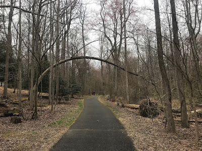
A few weeks ago, in a rush of gratitude, I emailed a stranger whose maps I had recently accessed online. It’s thanks to his map that I’ve been exploring the paths in a woods not far from here, the one where I finally found the Northwest Passage. 

I wasn’t expecting to hear anything back from the man, but I did want him to know how much I’ve been appreciating his maps and commentary, what a difference they’ve made for me.

Late yesterday, I heard from him. He’s 88 years old and doesn’t check his email as often as he used to, he said. But he credits all the walking he’s done with being alive now.

Quite an endorsement for walking in the suburbs. Or for walking anywhere. 

A Mind of Its Own

A Mind of Its Own

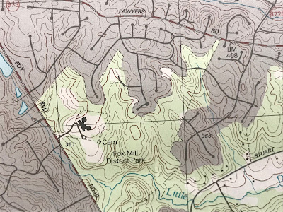
It’s been a while since I studied a topographical map. I’ve had to refamiliarize myself with those little squiggly lines. The closer they are together, I remember, the greater the elevation. 

Sometimes there’s a little number there to help. In the case of my terrain it’s a little number in more ways than one, something in the 300 range, as in 367 feet above sea level. 

But even 367 can be felt in the legs on the way up — and on the way down. It’s a good reminder that the land has a texture and a contour. That it has a mind of its own. 

A Map, A Direction

A Map, A Direction

It’s often this way in the morning, the competing urges. Should I walk … or write about walking? Today’s early rising has left me even more muddled. I remembered a website with trail maps from the area, and I’ve spent the better part of an hour exploring the site.

One of the maps charts a park near me, a park with poorly marked trails I’ve always wanted to explore. If and when I figure them out, I’ll be able to reach the Reston trails without driving to them  — or at least that’s the plan.

The map is printed. All that remains is to drink the tea, eat the breakfast … and set off.

Many Nations

Many Nations

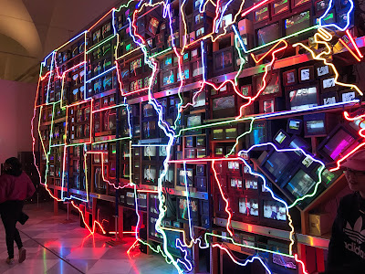
Like many Americans these days I spend a fair amount of time wondering how we’ve become so polarized. It’s not just because we’re in an election season. It’s hard to read a newspaper, watch television or even carry on a conversation without noticing the rifts, which seem to grow deeper by the day.

Now that I’m reading American Nations by Colin Woodard, I have a better idea why this is happening. Although written before the most recent shenanigans (it was published in 2011), the book provides a history of, to use Woodard’s subtitle, “the eleven rival regional cultures of North America.” 

I’m learning about the Tidewater, where I live now, and Appalachia, where I grew up — although Woodward admits that the Bluegrass region of Kentucky (my original stomping grounds) might be considered a Tidewater enclave within Greater Appalachia.  And I’m gaining a better understanding of how the tolerant, anything-goes attitude I love about New York City harkens back to the founding of New Amsterdam and its mercantile roots.

We’re less of a melting pot than a large, lumpy stew. And Woodard is helping me understand why.

Tossing the ‘Bible’

Tossing the ‘Bible’

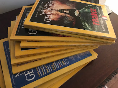
When I think of National Geographic magazine, I think of mountains and mummies and majesty. I think of the Bible, since I’ve always approached the magazine with reverence, thanks to its plethora of fine photographs and its perfect binding. I also think of George Bailey in “It’s a Wonderful Life.” Early in the film, when he’s a kid, he boasts that he’s been selected for membership in the National Geographic Society. 

Well, I was, too. And I can tell you what it’s like decades later, when you don’t throw out any of those precious journals, when you don’t even let your kids cut them up when they begged you to let them. Instead, you held onto the magazines, thinking they were too beautiful to toss, that somebody would want a complete set someday. A library, a nursing home, someplace.

But in a world where you can’t even give away a piano, you certainly can’t interest anyone in boxes of National Geographic magazines. In fact, you can’t even throw them all away at once; they’re too heavy. So we’re getting rid of them box by box. It’s like slowly peeling off a bandage — a painful process. But in the end, we’ll be a little bit freer, a little bit lighter, and these days, that’s what it’s all about.  

Mapping My Walk

Mapping My Walk

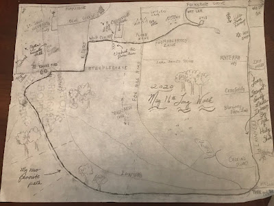
Inspired by The Writer’s Map, which I mentioned here a couple weeks ago, I embarked on a map-making project of my own. The result is “May 16th Long Walk,” an amateurish work if ever there was one, but the first in a series, I hope, as I record the walks I take not only in words but also in cartography.

It was an interesting experience, chiefly because I haven’t done anything like this since, oh, about seventh grade (I can’t recall drawing any maps since high school other than ones scrawled on the back of envelopes in the old pre-GPS days) and also because, as is quite evident, I can’t draw.

Creating this map called on that other side of my brain, the one that involves spatial relations (a perennial worst score on the SATs) and whimsy (which, though not tested, is far too often neglected).

But once I began creating this little map, I realized I could put anything on it —even silly things like the chain-link fence I had to climb and the large drainage pipes I call Snake Eyes. I realized I could be creative in a way I hadn’t been in a long time. Mapping, like writing, is a way to make a place your own.

Book Maps

Book Maps

I’ve loved maps since I was a child. I grew up with a mother who would eat her lunchtime sandwich and pickle while looking at a map, feeding her body and her soul at the same time. I’ve done the same off and on through the years (minus the pickle).

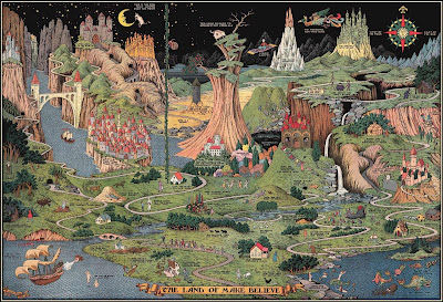
If I were to write another book, I’ve long hoped it would be the kind of book that would have a map in its frontispiece. I had no idea that so many others felt the same way. Enough to fill an entire book, The Writer’s Map: An Atlas of Imaginary Lands, edited by Huw Lewis-Jones.

I found this book on my last trip to the library March 15, and since I’ve not yet had to return any of those books, I’ve had plenty of time to savor this one. In it, authors from Philip Pullman to Robert McFarlane wax lyrical about the book maps that inspired them and the books they’ve written because of them.

“A map helps to make an imaginary place real. The more detail you put into your beautiful lie, and the more you base it on things that are true, the more it comes alive: for you and for your readers,” says Cressida Crowell in one of the book’s essays called “First Steps: Our Neverland.”

Crowell sees maps as story starters. “When I draw the map of my imaginary world, it will tell me the direction I want to be going in, even when I don’t yet know it myself.”

I’m starting my own map soon.


(Photo: The Land of Make Believe from The Writer’s Map by Huw Lewis-Jones.)
Mind Travel

Mind Travel

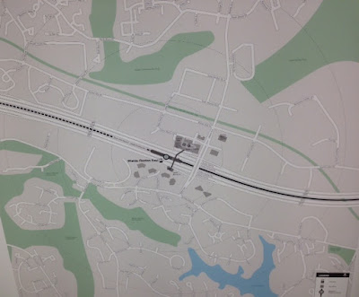
I whiled away some Metro wait time this morning staring at a map in the station. This is one for Reston-Wiehle, the current (but I hope not forever) western terminus of the Silver Line. I fixate on the southern exit,  how I could cross Sunrise Valley Drive at Commerce to Wethersfield then cut through the golf course to Durand and Purple Beech.

From there I’d take Soapstone all the way to Lawyers, Steeplechase and home.

It’s a walker’s fantasy. An hour-long walk at best. It would involve the kind of time I don’t have anymore.

For me, for now, the route is for mind travel only. A way to let the walker’s imagination wander while the walker’s body is doing what it has to do.

Map Quest

Map Quest


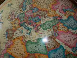
Yesterday Tom went to the map store to buy a world atlas — and the store was out of business. I did a little googling and found out that the store had been around for 40 years and that Tom missed the last day — and the incredible sale — by less than a week.

Then I thought, it’s the googling that’s the problem. Google Maps, that is. And Mapquest, and of course, the GPS. But today I don’t write to lay blame, only to celebrate. So let us now praise the printed map, from fold-out models to large, laminated ones that cover most of a wall. From globes to atlases. From street maps to nautical charts.

Maps let us see where we’re going and where we’ve been. They offer us all the possibilities, not just a narrow route ahead. I can stare at a map for hours, studying how one road leads to another, imagining the lives of the people who live where I’m looking. I love the way a map feels after it has a few trips under its belt, wrinkled and dog-eared, softened from use. In time it takes on the land it chronicles, becomes part of the process. A map is tangible proof of the miracle of travel, armchair or actual.